Wye Valley South Forest Resource Plan - Approved 14 March 2023
Location and setting
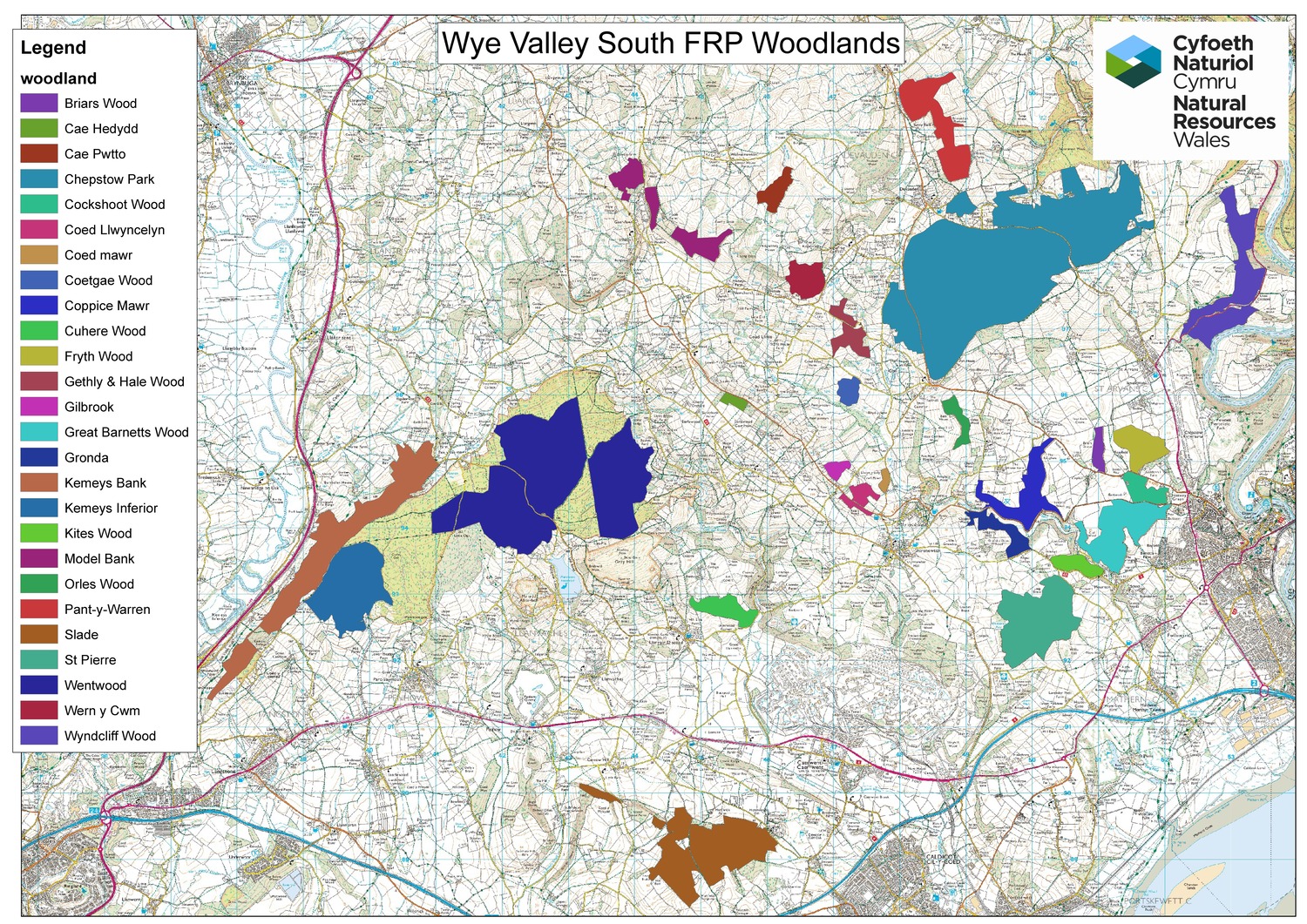
The Wye Valley South Forest Resource Plan is made up of 27 woodlands in Monmouthshire and Newport County, covering approximately 2077 hectares. The setting for of the majority of the woodlands is mostly improved agricultural grassland, native broadleaved woodland, and urban centres. The majority of woodlands are Plantations on Ancient Woodland Sites (PAWS) or Ancient Semi Natural Woodlands (ASNW), with the Wye Valley being one of the most important areas in Wales for Ancient Woodland. The woods are also well used by the local community for informal recreation.
Summary of objectives
The following management objectives have been agreed in order to maintain and enhance the resilience of ecosystems, and the benefits they provide:
- Restoration of the ancient woodland in the FRP area is a primary objective in line with the SE Area Statement, WG Woodland Strategy, and Wye Valley AONB Action Plan, with gradual removal of existing conifers over time through LISS allowing natural regeneration of broadleaves and diversification of species.
- Maintain timber production where appropriate, including productive broadleaves. This will provide opportunities to diversify species and structure of the woodlands, which will enhance the sustainability and resilience of the forests, as well as provide economic benefits.
- Diversify the forest species composition to increase resilience to pests and diseases, and the effects of climate change, whilst building a robust forest for future generations, including the prevalence of Douglas Fir in Chepstow Park and Fedw Wood. Remove remaining stands of larch, manage ash, and manage invasive non-native species appropriately.
- Invest in forest infrastructure to provide better access to allow more diverse management prescriptions within the woodlands, carry out regular thinning where possible, remove remaining larch stands, and conservation objectives.
- Work with partners and other NRW teams to identify and deliver opportunities to connect and enhance priority habitats, protected areas within and adjacent to FRP woodlands, and priority and protected species, to improve resilience and connectivity and prevent negative impacts from management activities. Such as connecting and restoring ancient and native woodland, connecting open habitats and rides, taking account of the various bat species present in the area during any management activities, and creating varied edge habitats where they adjoin non-woodland habitats, across the FRP area.
- Work with partners to encourage and increase responsible use and low impact recreation on the WGWE to deliver wellbeing benefits for local communities, user groups and visitors, and to reduce anti-social behaviour, including off-road vehicles, unauthorised mountain bike routes, and fly tipping.
- Forestry management should not contribute to the existing level of flood risk both within the woodlands and anywhere offsite and where possible, measures should be implemented to reduce any potential risk of flooding; both are to be achieved through good forestry practice in accordance with the latest UK Forestry Standard and relevant forestry guidance; and through consultation and engagement with the relevant Lead Local Flood Authority during planning of felling operations. Consideration of measures to reduce the volume of flows leaving forest blocks as a result of felling operations should include Natural Flood Management.
- Forestry management should not cause any reduction of water quality both within on-site water features and watercourse draining off-site through good forestry practice in accordance with the latest UK Forestry Standard and relevant forestry guidance.
- Work with our partners and communities to identify how and where the WGWE can deliver nature-based solutions for health and wellbeing and provide opportunities to connect people with nature, and where we can involve communities in its management.
- Being good neighbours - Consult and engage with neighbours, communities, and other stakeholders regarding the management of the WGWE and upcoming operations to improve relationships and knowledge on how and why the estate is managed, reduce conflict, and encourage closer working relationships.
- Work with neighbours and other stakeholders to manage and monitor deer, grey squirrel and wild boar on the WGWE and neighbouring areas to reduce negative impacts.
Maps
Location map
Long-term primary objectives map
Forest management systems map
Indicative forest types and habitats map
Comments or feedback
If you have any comments or feedback, you can contact the Forest Resource Planning team at frp@naturalresourceswales.gov.uk