
Beddgelert Forest, near Beddgelert
Huge forest in the heart of Eryri National Park
There is car park maintenance going on throughout Gwydir Forest Park. Parking may be restricted at times. Please follow all signage and instructions.
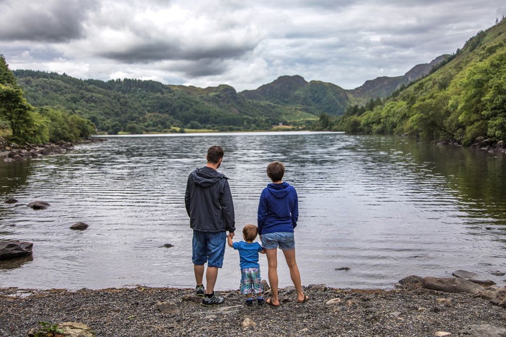
Llyn Crafnant lies in a beautiful valley where the edge of the forest meets the lower slopes of the Carneddau mountains, and the view from the head of the lake over the water to the mountains is one of the finest in North Wales.
“Llyn” is Welsh for lake but Llyn Crafnant is actually a reservoir and it was once the water supply for the nearby town of Llanrwst.
The lake was given to Llanrwst by Richard James in 1896 and the townspeople erected the monument next to the lake to commemorate the gift.
The waymarked walks set off from the car park, one of which is an accessible trail along the riverside, and you can also walk to the nearby lake of Llyn Geirionydd.
The reservoir and lakeside café are privately owned.
The walking trails are waymarked from start to finish.
Look out for the information panel at the start of the trails.
Find out about walking trail grades.
Try this easy short trail, suitable for the whole family, winding its way through a variety of trees, from tall conifers to young birch and an open grassy area next to the bubbling river.
Take a seat at one of the well-placed picnic benches and listen and watch for wildlife.
Or find the ‘disappearing signs’ along the trail, which tell you some fascinating facts about the trees and wildlife that live in the area.
Take in the view across the lake to the crags at the head of the Crafnant Valley and Cwm Glas Crafnant National Nature Reserve.
Follow the trail climbing gently up the valley; the view is framed by imposing crags and old slate mines.
The woodland on the steep cliffs above is a rare type of ash woodland.
There are no paths through the very steep reserve so it is best viewed from this walk.
Return to the car park by following the tarmac road.
Accessibility information
This trail is suitable for people using adaptive equipment.
Adaptive equipment includes adaptive cycles, adaptive wheelchairs and mobility scooters.
We have produced a film about the trail to help you work out how suitable it may be for you before you visit.
To watch the film, go to Trails for users of adaptive equipment
Admire the panoramic view across the Crafnant Valley, with the Carneddau mountain range visible behind.
Climb steadily up a forest track to reach a log bench, and from here take in the view of Crimpiau and Craig Wen across the valley.
Continue until the waymarkers send you off on a narrow forest path.
You’ll feel a change in atmosphere as you step into the dense shade and silence of a spruce plantation.
Apart from the occasional squawk from a jay, the stillness is a pleasant contrast to the buzz around the lake on a busy day.
This trail goes through the forest and takes in the two beautiful lakes of Geirionydd and Crafnant.
Llyn Crafnant is in Gwydir Forest Park.
Gwydir Forest Park lies in the heart of the Eryri National Park and encircles the village of Betws-y-coed.
Lead and zinc mining once dominated the area and the legacy of old engine-houses, waste tips and reservoirs are characteristic features of the forest landscape today.
Several of the most important mines have been partially restored and made safe for visitors.
Waymarked trails start from Betws-y-coed and several other Natural Resources Wales car parks in Gwydir Forest Park:
Gwydir Forest Park is set in Eryri National Park.
Eryri is the largest National Park in Wales and is home to picturesque towns and villages and the highest mountain in Wales.
It is looked after by the Eryri National Park Authority.
For more information about visiting Eryri go to the Eryri National Park Authority website.
We want you to return home safely after your visit here.
You are responsible for your own safety as well as the safety of any children and animals with you during your visit.
For advice and tips to help you plan your visit here go to Visiting our places safely.
Facilities for visitors with disabilities at Llyn Crafnant include:
The Llyn Crafnant Circuit is suitable for people using adaptive equipment.
Adaptive equipment includes adaptive cycles, adaptive wheelchairs and mobility scooters.
We have produced a film about the trail to help you work out how suitable it may be for you before you visit.
To watch the film, go to Trails for users of adaptive equipment
Please check the top of this webpage for any changes to these standard opening times.
The toilets are open at all times.
The lakeside café is privately owned.
See the top of this webpage for details of any planned closures or other changes to visitor facilities here.
For your safety, always follow instructions from staff and signs including those for trail diversions or closures.
We may divert or close trails whilst we undertake maintenance work or other operations and we may need to close other visitor facilities temporarily.
In extreme weather, we may close facilities at short notice due to the risk of injury to visitors and staff.
You may need permission from us to organise an event or to carry out some activities on our land.
Check if you are allowed to use our land.
We recommend you follow these directions or use the Google map below which has a pin on this place’s location.
Llyn Crafnant is 4 miles west of Llanrwst.
Follow the B5106 from Llanrwst to Trefriw.
In Trefriw turn left onto a minor road opposite the pub.
Follow this narrow road for 2 miles until you reach the car park, just before the road reaches the lake.
The Ordnance Survey (OS) grid reference for the car park is SH 756 618 (Explorer Map OL 17).
The postcode is LL27 0JZ. Please note that this postcode covers a wide area and will not take you directly to the entrance.
View this place on the What3Words website.
The nearest mainline railway station is in Llanrwst.
For details of public transport go to the Traveline Cymru website.
The Natural Resources Wales car park and toilets are located just before the road reaches the lake.
Parking is free of charge.
Overnight parking is not permitted.
There are no staff at this location.
Contact our customer team for general enquiries during office hours, Monday to Friday.


